Field boundaries can be imported as a shape file or manually drawn using the Agvance SKY Mapping drawing tools. A boundary must be added to the Field before saving.
Importing a Boundary
- Select Import.
- Select the shapefile for the Field being added, and choose Open.
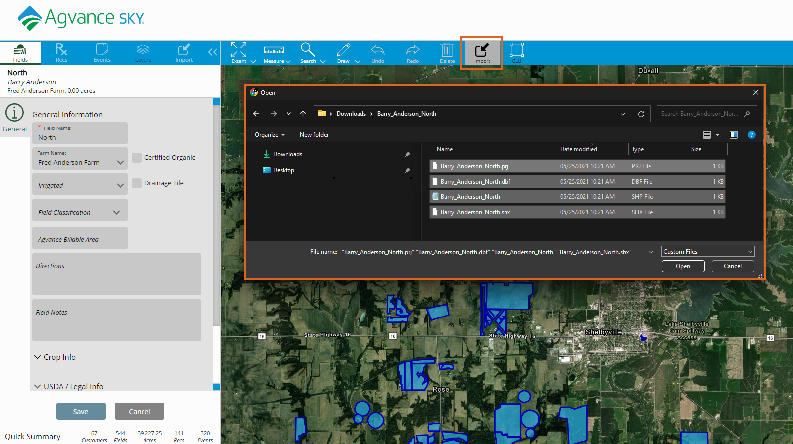
- Make any needed boundary adjustments and select Save.
Drawing a Boundary
- Select Draw.
- Choose the Polygon or Circle tool, and trace around the Field boundary.
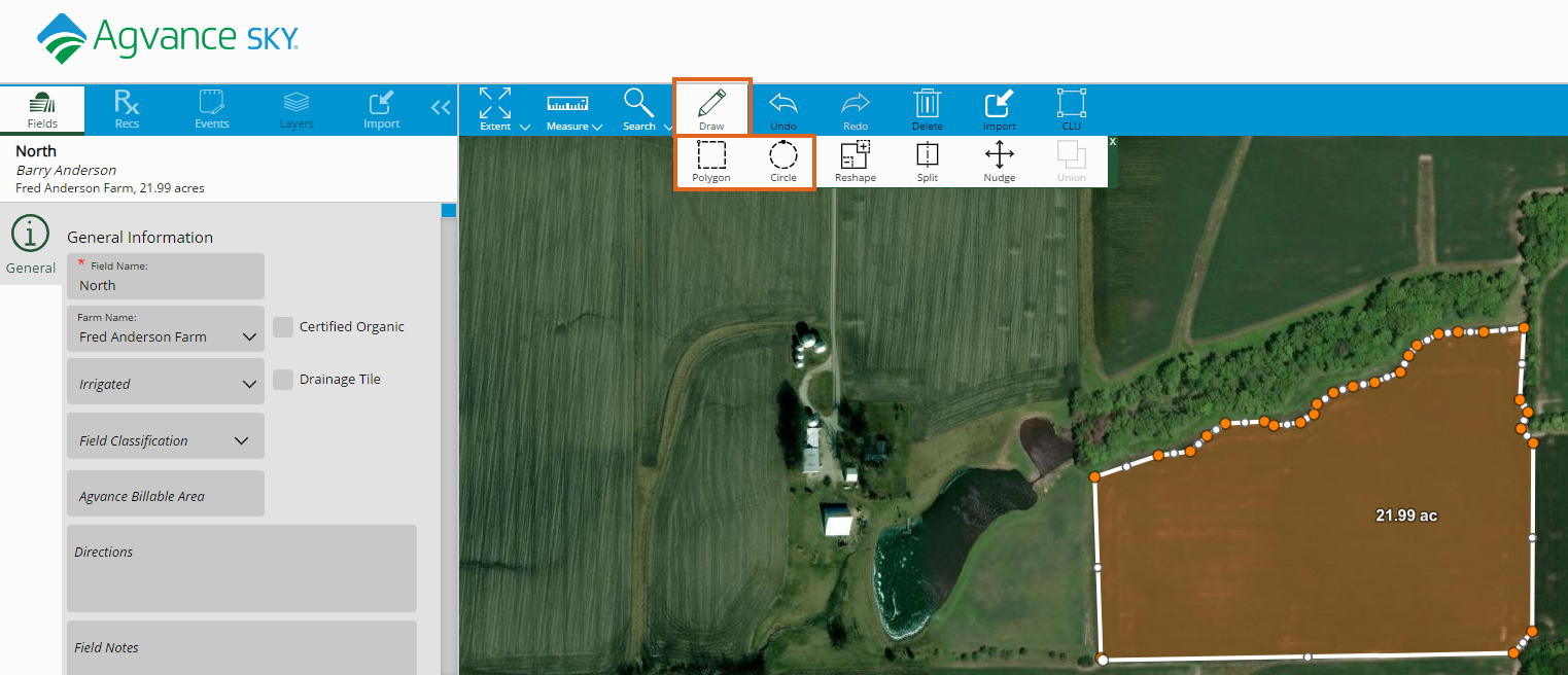
- Double-click to close the boundary.
- Select Save.
Editing a Boundary